

Front Page
WHAT A WEEK THAT WAS!
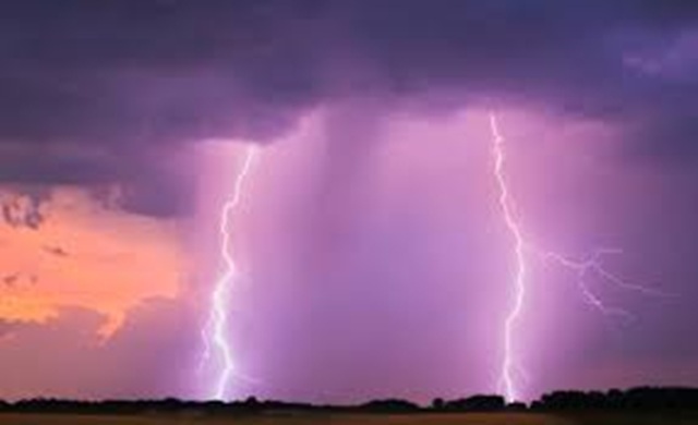
What a weather week! Tuesday night, an EF-1 hit southwest of East Troy in Walworth County at approximately 8:20 p.m., with winds up to 100 mph. The National Weather Service confirmed a tornado touched down in Walworth County on Wednesday night, April 15. An EF1 was confirmed north of Delavan and west of Elkhorn. It touched down just after 8 p.m. and was on the ground for two miles.
The NWS said it had estimated wind speeds of 100 mph and caused damage to trees and buildings. The National Weather Service (NWS) has confirmed that a total of three tornadoes touched down in Walworth County on the evening of Friday, April 17. An EF-1 tornado with estimated peak winds of 100 mph touched down in Walworth County just north of School Section Road in Delavan near the Village of Darien around 6:40 p.m. Friday, according to the NWS. According to the weather service, this powerful tornado traveled along State Road 11 into the Redwood Court neighborhood of Delavan. Pine trees were uprooted and snapped; a few outbuildings had their sheet metal torn off from their roofs and walls, and an empty concrete silo was toppled.
An EF-1 tornado with estimated peak winds of 100 mph touched down around 6:46 p.m. in Walworth County near Turtle Creek and Klug Road in Delavan, according to the NWS. The weather service says this tornado lifted northeastward through the northern portions of Comus Lake by Dam Road. The tornado uprooted or snapped multiple trees along the path, pushed in metal doors on a large metal building, and pulled off shingles on a garage and a house.
An EF-0 touched down around 7:22 p.m. in Walworth County along Spring Prairie Road in Burlington just southwest of the unincorporated community of Honey Lake. The NWS says the tornado was 50 yards wide with peak winds of 70 mph and traveled east-southeast along Spring Prairie Road. Wisconsin has not seen weather of this magnitude over such a long period of time (when it comes to tornadic activity) since just after World War II.
The number of tornadoes and tornado warnings that went up and down Wisconsin, north to south, then Illinois, Missouri, Iowa, and more, just blew everyone away. There is no explanation for this kind of weather, as global warming does not truly explain it. About the only thing that is certain about global warming is the near impossibility of predicting this kind of weather until it is right upon us all. The predictions for three straight nights were all made at the very end or just before the damaging parts of the storm fronts were already hitting one community after another.
People in all the states affected were so unused to the reality of this kind of full-on frontal attack that they stayed out on roads in their cars and trucks long after they should have been taking shelter. Many could be seen on television weather and traffic cams sheltering under overpasses which is a rotten idea when tornados are in the vicinity because the vortex of a tornado spinning nearby can be much stronger under that overpass than otherwise, not to mention the number of times that anyone watching at home could observe traffic being forced to totally stop because of cars under overpasses not getting out of the way of those behind them.
All the media can do is what the Geneva Shore Report is doing here, try to indicate the best course of action when geologic or weather damage is expected; even if the warnings come very late, they are much better than no warnings at all.

